
The rivers of Mauritius
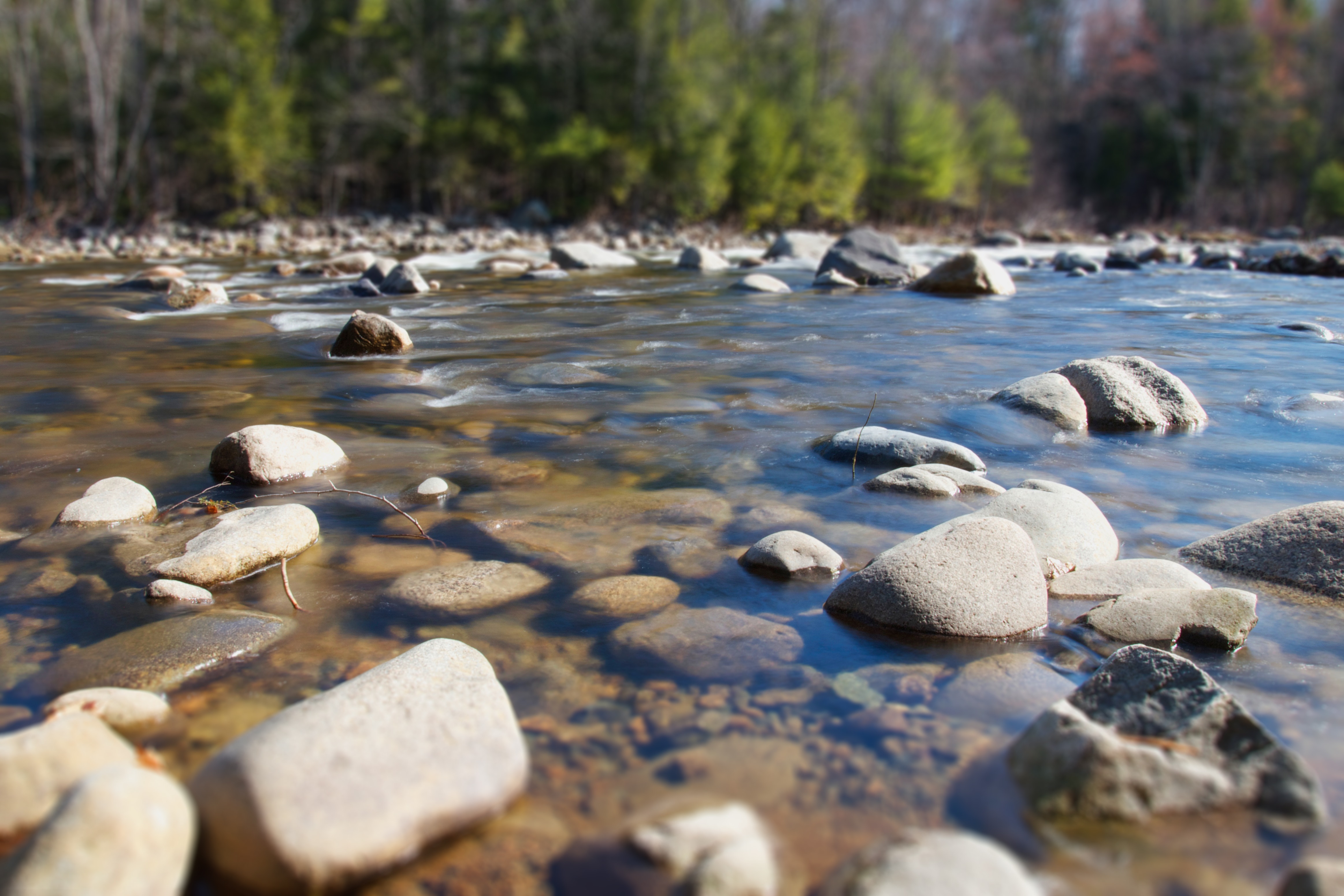
Rivers are water bodies within a confined channel that usually flow from the uplands towards a lake or the sea. They are very important in shaping the landscape and allowing the surrounding life to survive. Rivers can flow all year round or only flow temporarily during the rainy seasons. In Africa for instance, river flow decreases during the dry seasons and thus these water points become little survival camps for the wildlife. Rivers are normally fed by melting snow, glaciers, springs or upstream lakes. They can run for several kilometers or be as short as a few meters.
How were rivers formed in Mauritius?
Due to the small size of the island, there are no real rivers; they are mostly 4th to 5th order streams due to the amount of water that they carry and their length. Rivers in Mauritius are fed by underground reservoirs which eventually overflow into water channels. Some rivers flow permanently while others surface up during the wet seasons. This is mainly because permanent rivers have a consistent base flow of stored water while ephemeral rivers fill up only when it rains.
Most of the rivers on the island originate from the Central Plateau that is constantly moist throughout the year and flow downwards to the sea. Development of rivers is mainly based on the porosity of the land, the amount of precipitation, the amount of infiltrated water, the amount that spills off, the geography of the land and the vegetation in the surroundings. River development is radial; they arise from one point, the central plateau, and flow to the sides in branches. For example, Plaine Champagne is one of the most elevated points of the island at 700 m: many streams start their journeys from there.
Longest rivers in Mauritius
There are 25 major rivers and 21 smaller rivers on the island. The longest river is the Grand River South East, 34 km in length, which also has the largest catchment area. GRSE has its source on Butte Chaumon and flows down alongside its tributaries namely Riviere du Rempart, Riviere Vacoas, Riviere Francoise through sugarcane and tea plantations. It cascades over a series of lava flows from Pave Citron Bridge until it meets the sea into a funnel-shaped estuary.
The second longest river, 22 km long, is the Grand River North West. In contrast to GRSE, GRNW lies within urban areas even though a good part of it flows through sugarcane fields. It starts from the central plateau where underground water gives rise to several small tributaries namely Riviere Cascade, Riviere Moka, Riviere Terre Rouge and Riviere Plaines Wilhems. GRNW ends in the shallow Grand River Bay where a small delta has gathered amongst rocks.
List of the main rivers of Mauritius and their associated tributaries [1]
Port Louis region
- Grand River North West
- Ruisseau Saint Louis
- Rivière des Lataniers
Rivière Noire
- Petite Rivière
- Rivière Belle Ile
- Rivière Dragon
- Rivière des Galets
- Rivière le Lièvre
- Rivière Tamarin
- Rivière du Rempart (tributary – Rivière Papaye)
- Grande Rivière Noire
- Rivière du Morne
Savanne
- Rivière du Cap
- Rivière Creole
- Rivière Saint Martin
- Rivière Jacotet
- Rivière des Galets
- Rivière Savanne (tributary – Rivière Patate)
- Rivière Michel
- Rivière Gombo
- Rivière des Anguilles (tributaries – Rivière Songe and Rivière Pipe)
- Le Gros Ruisseau
- Rivière Dragon
- Rivière St Amand
- Rivière du Poste (tributaries – Rivière Citron, Victoire and Marron)
Grand Port
- Rivière Tabac
- Rivière Violette
- Rivière La Chaux (tributaries – Eau Bleu and Bémaniques)
- Rivière des Creoles
- Rivière Champagne
- Rivière Nylon
Flacq
- Grand River South East (tributaries – Rivière Profonde and Rivière du Rempart)
- Rivière Sèche
- Rivière du Poste (tributaries – Rivière Coignarde, Sarcelle and Céré)
- Rivière Françoise (tributaries – Rivière Grande Barbe)
Rivière du Rempart
- Rivière du Rempart
- Ruisseau Grand Marais
- Ruisseau Citronniers
Pamplemousses
- Rivière de Pamplemousses (tributary – Rivière Citron)
- Rivière du Tombeau (La Nicolière Reservoir, Rivière Pieter Both and Rivière Rose from Pieter Both feed it.)
Importance of rivers
Rivers are important from both the ecological and economic standpoint.
Ecological
- They help in the transfer of water itself from its source, down its course so that other organisms can benefit from it.
- Rivers ensure the distribution of nutrients from place to place as well as help dissipate dischargeable products from one point.
- They help in landscaping the environment; for instance, the flow of water along the land results in valleys, crevices and canals.
- These watercourses offer a unique environment for freshwater organisms like fishes, eels, shrimps and water plants.
- Where river banks overflow often, wetlands can form. Wetlands are wonderful natural sites that act as pollution sinks.
Economic
- Though there are small rivers in Mauritius, on continents with large rivers, the water bodies are used as a transport medium. The best that we see here is recreational paddling or fishing on small boats at GRSE and the bay of GRNW.
- Rivers are places where fishes and plants are commercially grown which in turn provide food and bring back money.
- Overflowing of the water banks during heavy rainfall provide fertile soil which can be used in agriculture. Watercress and Brede Songe are commercially cultivated in this way.
- Streams that flow through private land are used for recreational activities like fishing.
- One very important use of rivers is that they are dammed and made into reservoirs to feed the general population with paid water.
- Or else, they can be used to produce electricity in hydroelectric power stations like the one at Plaine Champagne.
- Water from rivers can be directed towards cultivated fields and used to irrigate crops.
- Rivers help to transport excess water downstream during rainfall. Man-made alternatives would cost in the millions, as would flooding in the absence of natural canals.
Other uses of rivers
In some cultures, rivers have religious meanings. Hindus, for example, consider river banks as sacred places where they build their altars. In addition to this, psychologically, rivers and the surrounding environment provide a serene atmosphere to de-stress and initiate creativity in an individual.
Reference:
- B. de Burgh Edwards. (1921). Géographie Illustrée de l’ile Maurice. Port Louis, Mauritius: The General Printing and Stationery OY.Ltd, pp 8-11
Pingback: Wetlands of Mauritius: Importance and Ramsar Sites - Yo Nature
Pingback: Coral reefs of Mauritius - Yo Nature
Pingback: Extreme Weather: Flash floods become frequent in Mauritius - Yo Nature
Pingback: Flooding: Types, Dangers and Mitigation Measures - Yo Nature